


Recent satellite images captured by the International Space Station reveal the extent of devastation caused by the Maui wildfires. These images, taken four days after the wildfires broke out, depict the town of Lahaina and other affected areas from a distance of 259 miles above the Pacific Ocean.
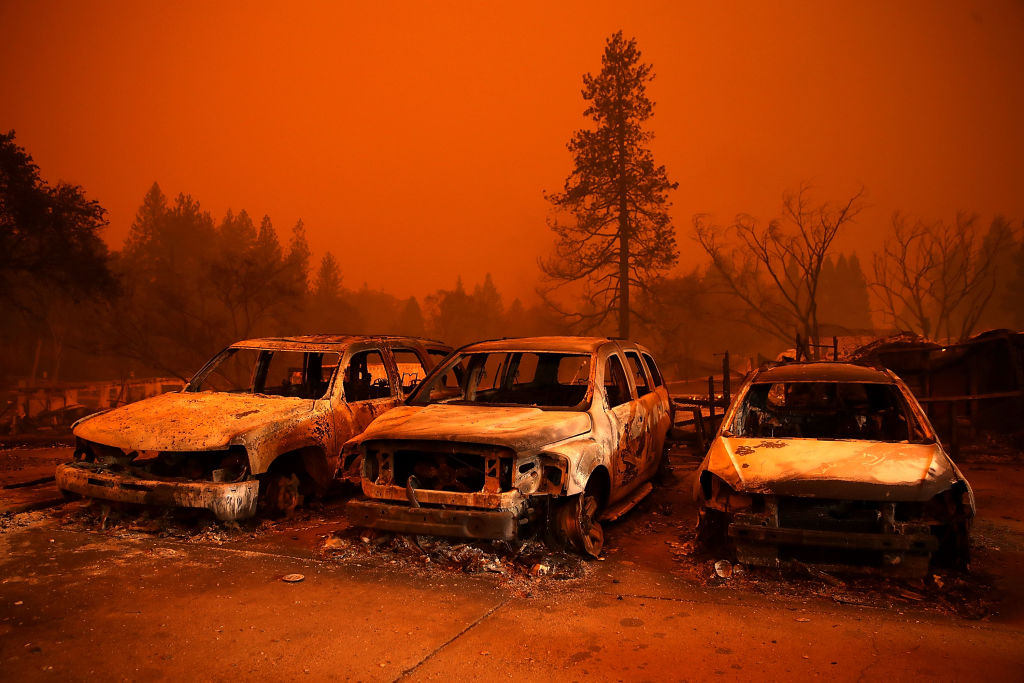
The images highlight the destruction in the coastal town of Lahaina, one of the hardest-hit areas. Much of the town’s infrastructure, including historic structures like the Waiola Church and natural landmarks like a 150-year-old Banyan tree, has been reduced to ashes. The aftermath of the wildfire paints a grim picture, emphasizing the tragic consequences of human-driven climate change.
The devastating impact of the wildfires has been widely documented, drawing attention to the urgency of addressing climate change on a global scale. With the death toll rising above 100, the catastrophe has been termed the deadliest wildfire event in the history of the state. Governor Josh Green expressed deep sorrow over the losses and the toll this disaster has taken on the community.
Images captured by other Earth-orbiting devices, such as NASA’s Landsat 8 satellite and Europe’s Sentinel-2 Earth-observing spacecraft, further emphasized the magnitude of the disaster. These images, taken on August 8, provided a haunting view of the wildfires, underlining the scale of destruction.
While the specific cause of the wildfires is still under investigation, experts have started to consider various contributing factors. NASA, during a press conference on August 14, speculated that local conditions, such as abandoned sugar plantations and non-native grasses, might have played a role in fueling the fires. However, the agency also stressed that climate change is a significant factor in exacerbating such disasters.
Gavin Schmidt, director of NASA’s Goddard Institute for Space Studies, stated, “Climate change is a kind of threat-multiplier for wildfires.” The increasing frequency and intensity of wildfires worldwide are a stark reminder of the urgent need to address climate change and its impact on our environment.
Local officials announced on August 15 that the fires are mostly contained. However, they caution that “100% contained” does not equate to complete extinguishment. Thousands of people were displaced due to the wildfires, and thousands more remain missing. The images captured from space serve as a stark reminder of the vulnerability of our planet and the need for collective efforts to mitigate climate change and its devastating consequences.
Sources By Agencies